
“How far to the Summit?”
“You’re almost there–it’s just on the other side of the tunnel—you’ll need a torch, it’s pretty dark inside.”
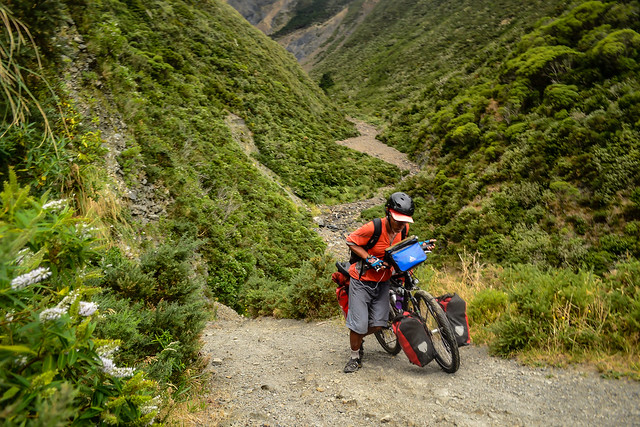
I was relieved. We’d just dragged our bikes through the washout at Siberia Gully. I was hungry. I was getting tired. This was a bad combination. It generally heralded the coming of grumpy.
The idea of reaching the summit and firing up the stove for a Sunday brunch appealed to me. The Summit! I’d feel as if I’d earned the right to tuck into a spread of fried eggs and toast with a side of instant mash potatoes.
No matter “the summit” was just a few hundred meters above sea level.
It was a Sunday morning on the Rimutaka Rail Trail. The mountain was teeming with weekend warriors on flash mountain bikes.
“You goin’ all the way to the top?” they’d enquire, sizing up our loaded bikes.
“Yeah,” I’d reply, giving my super cool hard-core world cyclist look. “It’s not much of a climb.”
And it wasn’t. In distance.


The Rimutaka Rail Trail was originally a rail route built in 1878 to link the Hutt Valley and Featherston. The line transported passengers up the incline from Cross Creek to Rimutaka Summit. The incline was steep, and a special system was designed to pull trains up the slope.
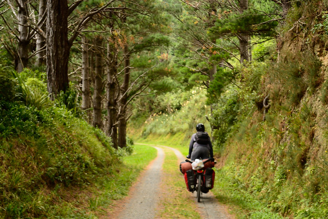
The modern day trail traverses 4 tunnels, and is made up of 2km of single track, 6km of double track and 15km of unsealed road.

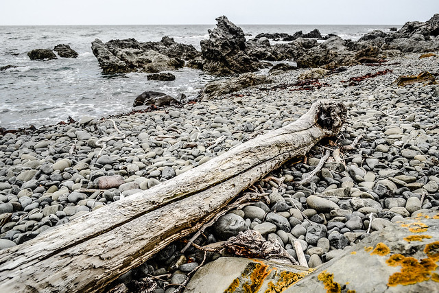
All in all, The Rimutuka’s not too rough a ride. Except for that ‘Siberia’ section I mentioned.
A friendly pair of mountain bikers in high-viz vests (all the rage in NZ) offered to help me lug the bike across the precipitous part.
“Thanks, I’m sure I’ll be fine,” I said. A girl’s got her pride, after all.
I regretted the decision as soon as the nice couple sped away and I got a glimpse of exactly what horseshoe gully (AKA Siberia) was made of.
Until 1967, there was an embankment across this hazardous stretch. Then a big storm washed it away. Now there’s just a deep gully with a sign stating “Steep, slippery approach to creek bed. Cyclists are advised to dismount and walk.”
Suffice to say negotiating Siberia entailed some serious hoisting and heaving accompanied by a fair bit of cursing.
Lesson learned: never turn down offers of assistance!
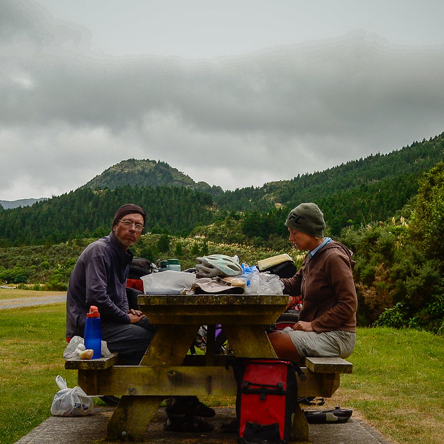

The Bureaucratic side of Travel
We had one final errand on the North Island: picking up new passports from the French Embassy. The French, unlike the Americans, refuse to add additional pages to full passports. That means you have to undergo the hassle of getting brand-new ones.
It used to be that you could apply for a passport in one country (say South Africa) and pick the new passport up in another country further along in your journey (Malawi in our case).
This was a highly convenient system.
The rules are now much stricter. You must apply in person at the embassy, your application is sent to Paris for processing, a new passport is issued in Paris and then sent back to the embassy you applied at for pick up.
This process normally takes a month. Wellington was perfect because we had just enough time to do a North Island loop before heading back to pick up the passports.
There was only one glitch. The folks in Paris messed up and Eric’s new passport expires in April 2014! That means we’ll have to go through whole rigmarole again in just a few month’s time.
Bound South
After a beautiful journey on the Interislander Cook Island Ferry, we arrived back on the South Island. I’d long wanted to cycle the Rainbow Trail. This was mostly thanks to Stephane Girard’s inspiring New Zealand cycling photos.
With time short, we decided to forego the longer inland route and take the shorter coastal road. Sadly, I’ll have to save the Rainbow for another trip.
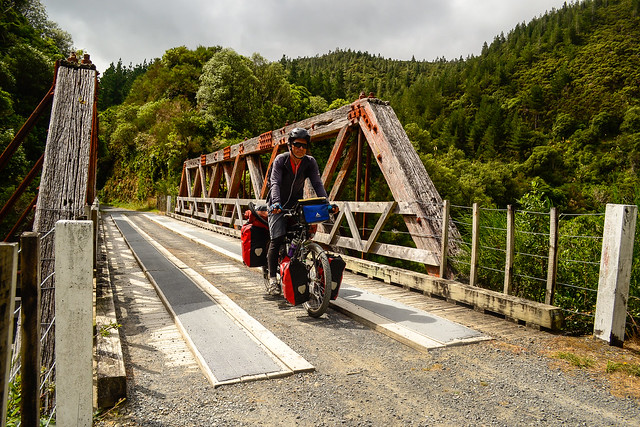
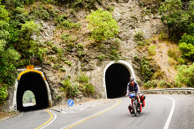
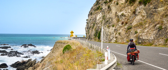
Highway 1 is the main road in New Zealand and runs the length of both North and South Islands. It’s busy, as you might imagine. Logging trucks ply this route, making it especially dangerous for cyclists. The high volume of traffic distracts from what could be some fine riding.
After leaving the ferry terminal at Picton, the road follows the Tuamarina River across the Wairau Plain. It’s deliciously flat cycling for 30 kilometers or so. After Blenheim, you traverse some pretty vineyards and then begin climbing through the Kaikoura Range. Highway 1 soon returns to the sea and twists its way along the pretty Pacific coast. The road is extremely narrow in spots here and there are a few scary tunnels to traverse.
Just when you thought you couldn’t survive another near miss on the narrow coastal stretch, the highway shoots inland through Hundalee Range before veering down to the Canterbury Plain and Christchurch.
Returning to Christchurch brought our tour full circle. We even stayed with the same couchsurfing host. In 3 months, all we managed to do was pedal 5,000 kilometers and see some beautiful places. In the same time, our host entered a new profession and started his own company.
I’ve always said I could return to the ‘real world’ without a problem. Now I’m not so certain.
Catch up on the latest news via the World Biking Facebook Page or connect with us onTwitter.
Drop as an email and say HI! at worldbiking@gmail.com
Having only just left NZ for Hobart, Tasmania, I can testify to some truly great cycling. I only circumnavigated the south island. That alone was fantastic with wild/freedom camping most of the time. I only used 3 DOC sites and 2 official campsites. Happy days indeed.
Happy Bicycle Warrior 🙂
So envious of your Tasmania trip–I’ve heard it’s some of the best biking in OZ!
Really loved reading about your NZ adventures. It looks like there are some fantastic quiet routes there to explore!
“the coming of grumpy” – know that feeling!
Yep, NZ’s lovely–a great place for you and Neil to take it easy after your hard- core adventures in the Andes and the Himalayas
I just went through your flickr slideshow, excellent, as per usual. A couple of nice macros in there, and some amazing vistas. Some of the sheepier parts of NZ look like they could be in Wyoming or Montana. Looking forward to more OZ pictures soon. I’m curious about your route this time, but will happily wait to see where you wash up. Wishing you both happy (or at least un-grumpy) and safe travels, rb
Glad you enjoyed the latest photos–I’m having a great time getting to know my camera better. And yes, NZ does remind me of Montana at times.
NZ looks great guys! All the best from Hong Kong…
Wow, you guys did the Rimutaka incline? Awesome! I just did it a few days ago and loved it notwithstanding Siberia Gully. The wind was very strong though, got knocked sideways off my bike!