discover another side of Oregon

old west scenic bikeway

Great getaway

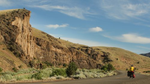
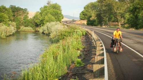
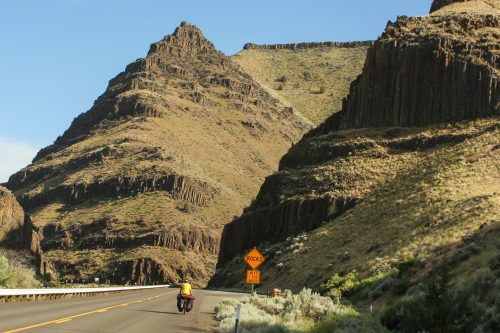
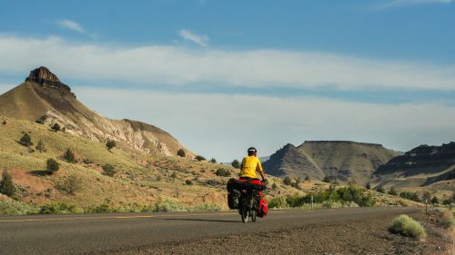
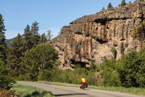
The Old West Scenic Bikeway offers a tantalizing variety of terrain and scenery. 

You’ll pedal past everything  from rushing rivers  and dramatic rock formations to steamy hot springs and ancient fossil beds. 

And if you’re someone who likes lung-bursting climbs, you’ll be rewarded with a few of those, too.

The Old West Scenic Bikeway is the perfect long weekend getaway. It’s a 2-3 day ride and very easy to follow. You won’t have to spend any extra time planning. Just get yourself to John Day (the starting point of the route) and start pedaling.

Essential info

Total distance: 174 miles/280 kilometers

Total climbing: 8,493 feet/2,588 meters

Fitness level: There are a few long, steep climbs so you should be fairly fit or prepared to walk up the hills.

Camping, accommodation and food

This is one of the best-supported Scenic Bikeways in Oregon. With ten bike-friendly communities along the route, you’ll find plenty of accommodation and food stops. You can also pitch your tent in one of the 7 campsites along the way.

Locals are accustomed to seeing bicycle travelers. You’ll be warmly greeted and be offered water top ups and help with directions (if you need it). 

Road angels are known to frequent this route. So don’t be surprised if somebody drives by in a pickup and tosses you a cold coke!

Water

Be sure to stock up on water whenever possible. Note that the BLM campgrounds DO NOT have water. The weather can be surprisingly hot in eastern Oregon so be sure to keep hydrated.
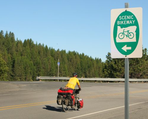
Old West Scenic Bikeway

The route

Oregon’s Old West Scenic Bikeway starts at Kam Wah Chung State Heritage Site in John Day. The route passes through the small communities of Prairie City, Long Creek, Monument, Dayville and Mt Vernon and then loops back to John Day.

It makes sense to start in John Day because it’s the largest town in the area.
You begin by heading east on Highway 26 and passing through picturesque Prairie City.

Then you will climb up to the turnoff at Austin Junction. Here you’ll be riding quiet rural backroads.

You’ll first pass through the little town of Long Creek.
Then it’s on to Monument and Kimberly before you head south to the John Day Fossil Beds.
At that point, you reconnect with Highway 26 heading back to John Day, passing through Dayville and Mt. Vernon on the way.

Old West Scenic Bikeway Map and GPS Tracks

Download the free Old West Scenic Bikeway GPS tracks

Old West Scenic Bikeway Route Details
Directions Notes/Points of Interest


0.0 East on US-26 from
intersection with Canton St
Scenic Bikeway route starts at entrance to Kam Wah
Chung State Heritage Site. Free overnight parking at
the Kam Wah Chung Interpretive Center. Cyclists
should check in with the park ranger to ensure that
their vehicle is in a state-owned parking spot.


0.1 Continue on US-26 Grant County Visitors Center – information, restrooms


13.1 Continue on US-26 Prairie City – stores, restaurants, lodging, camping,
museum


18.3 Continue on US-26 Conestoga Wagon viewpoint and visitor information


21.9 Continue on US-26 Dixie Summit – 5,277 feet


22.5 Continue on US-26 Dixie Campground (USFS) left 0.4 mile – restrooms,
no water


28.5 Left on OR-7 Austin Junction – restaurant, store, bike camping


29.6 Left on Grant Co Rd #20 Locally known as Middle Fork Rd, roadside springs immediately before intersection

30.1 Continue on Grant Co Rd #20 Bates State Park – hiker/biker camping, water. No
shower. No drinking water between Bates State
Park and Long Creek (mile 83)! Bring water filter
and/or carry extra water.


34.6 Continue on Grant Co Rd #20 Deerhorn Campground (USFS) – restrooms, no water


36.2 Continue on Grant Co Rd #20 Middle Fork Campground (USFS) – restrooms, no
water


43.0 Continue on Grant Co Rd #20 Boulder Creek Ranch – cabin and sheep wagon for rent


49.8 Continue on Grant Co Rd #20 Galena – historic site, no services


69.7 Left on US-395


82.7 Right on OR-402 Long Creek – store, restaurant, lodging, camping


94.0 Continue on OR-402 Hamilton – no services


103.8 Continue on OR-402 Monument – store, camping, water, restrooms


114.5 Continue on OR-402 Big Bend Campground (BLM) – restrooms, no water


115.7 Continue on OR-402 Lone Pine Campground (BLM) – restrooms, no water


117.5 Left on OR-19 Kimberly – store


126.3 Continue on OR-19 John Day Fossil Beds National Monument – restrooms,
no water


130.8 Continue on OR-19 John Day Fossil Beds National Monument, Blue Basin
Area – restrooms, no water

133.9 Continue on OR-19 John Day Fossil Beds National Monument, Cant Ranch
– restrooms, water, interpretive displays


134.0 Continue on OR-19 John Day Fossil Beds National Monument, Thomas
Condon Paleontology Center – restrooms, water,
interpretive displays


136.0 Left on US-26


136.4 Continue on US-26 Picture Gorge – narrow canyon with limited shoulder,
pictographs


142.9 Continue on US-26 Dayville – restaurant, store, water, bicyclist camping in
church


165.8 Continue on US-26 Mt. Vernon – restaurant, store, cycling hostel


167.0 Continue on US-26 Clyde Holliday State Park – camping, restroom, water


173.8 Route ends at Kam Wah
Chung State Heritage Sit


Old West Bikeway Oregon